Laikipia is Digitizing its Land Records
From Laikipia.go.ke
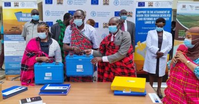
The County Government of Laikipia has unveiled a digitized land management system that will ease land transactions. The Geographic Information System (GIS) Laboratory in the department of Infrastructure, Lands and Physical planning will also improve the integrity of land transactions and planning in the county. It will help to curb cases of land fraud through integrated tracking system of land use.
The GIS has an audited database of the original Parts Development Plan (PDPs) that will which will be used to counter check authenticity before approvals on any land transaction. At a click of a button, an officer can countercheck the location of the land, ownership and any other related information needed before transacting land business. So far over 5,000 registry index maps (RIMs) and 1,400 PDPs from the Survey of Kenya have been digitized. The audit has revealed that 80 percent of PDPs are unapproved.
A large number of PDPs issued and in circulation are not legally bidding documents as they have not completed planning process. Our efforts should not cause panic since we are trying to bring sanity in the Land sector in Laikipia, Governor Ndiritu Muriithi said witnessing the digitization process last week.
He added that there is need to safeguard the instruments of approval as many title deeds are sitting on a quicksand. The best way to solve a problem is to acknowledge it and find ways to solve it.
Land owners should avail their PDPs for verification and use the GIS Lab to research on the source of the documents before any transaction. It will be a helpful tool for the individual dealing in land matter such as developers, lawyers and other partners. The services will be made available online very soon for residents to benefit.
The system will restore the integrity of everything concerning land in Laikipia. It will have information that will help us curb cases of frauds, Lands chief officer Eng. Dorcas Korir said. It will also help other government agencies in making informed decision as they can have access and be able to well plan for their projects. The CO noted that electricity agencies can check on how many people have been connected to power and the same case for the water providers to know how to extend to those not connected. The department is closely working with National Land Commission and County Land Registrar to get original PDPs in order to ensure they have a clean database. It will help in tracking the origin of the PDPs and verify the signatory of those issued.